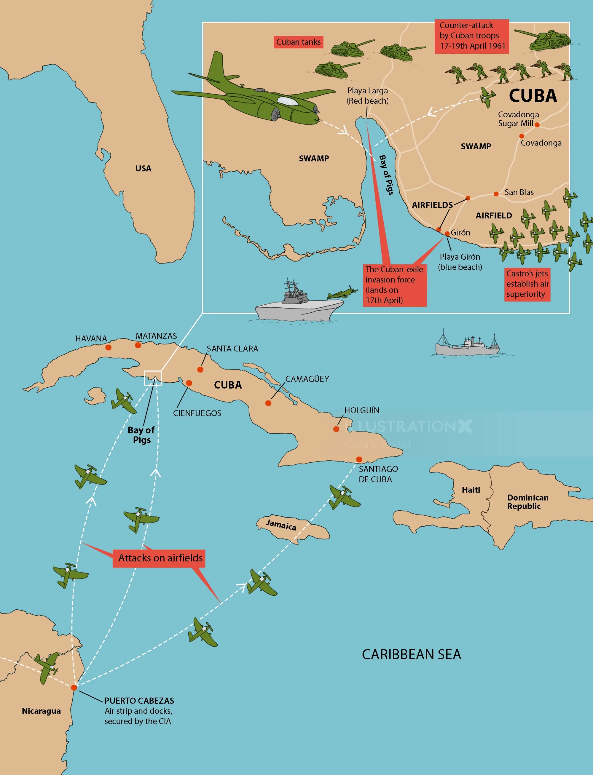
1960s in Maps, fully illustrated infographic book, published by Granta. Political map about the Bay of the Pigs conflict between Cuba, USSR and the United States.
Technically difficult map to convey the military strategies of the conflict, created in a concise and to the point structure.
If so, we represent many outstandingly talented animators, creating gifs, explainers, characters, stop motion and motion graphics for TV, film, games and digital streaming in 2d and 3d.